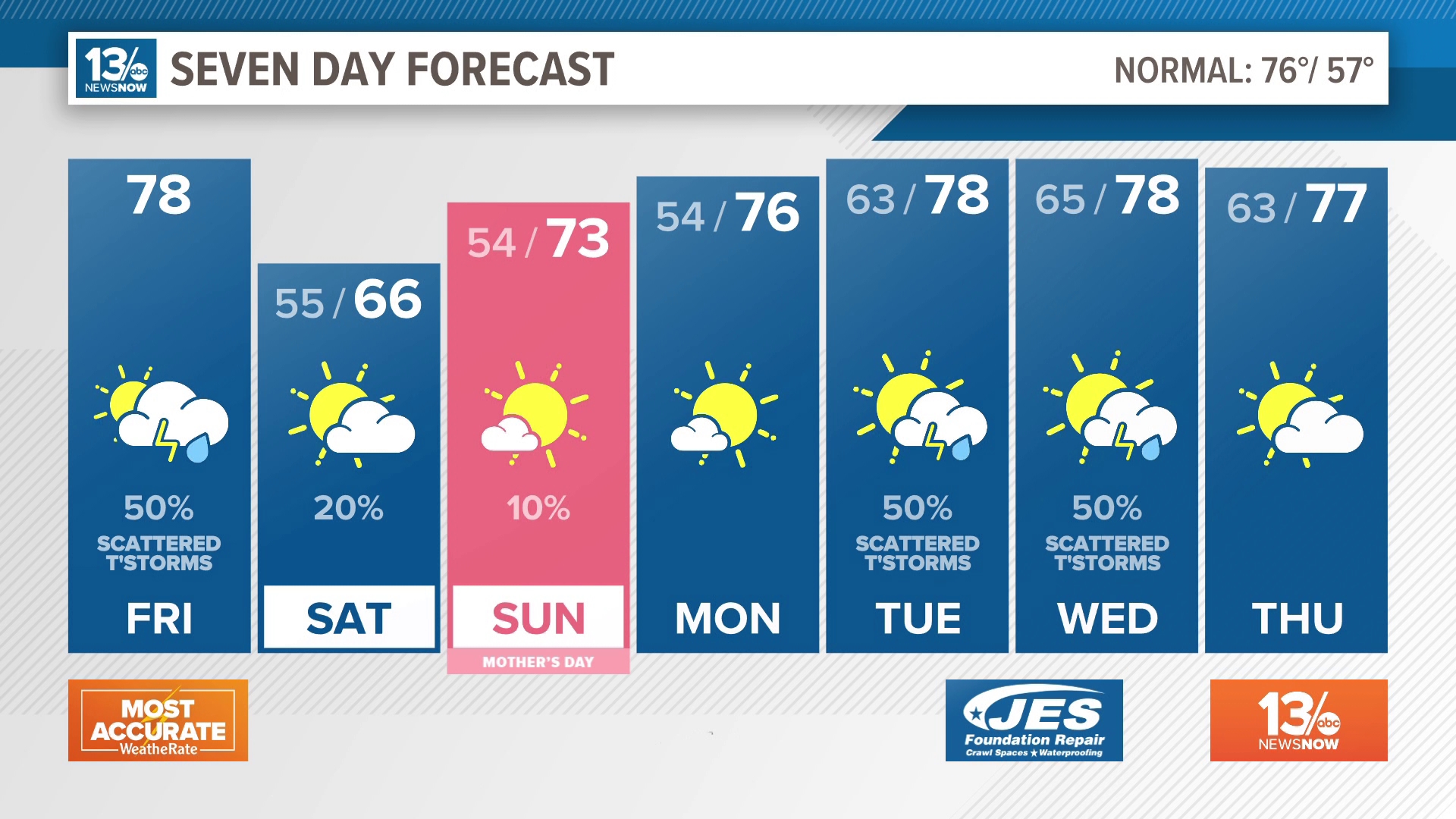
NORFOLK, Va. — Over the past week, Norfolk has experienced a cool spell with temperatures remaining below average since last Thursday. However, a significant shift is on the horizon...
Today, coastal temperatures will stay subdued due to persistent east and northeast winds, maintaining the cool and breezy atmosphere.
But brace yourselves for a turnaround as we head into the late weekend and early next week!
RELATED: FORECAST: Much warmer days ahead
A warm front is set to sweep through Hampton Roads on Saturday, ushering in moisture and enveloping the skies with cloud cover for the weekend's initial phase. A few isolated showers may also make an appearance during the day. Saturday's temperatures will climb slightly, reaching the mid-60s.
Following the warm front, southerly winds will take charge, bolstered by high pressure offshore. These winds will transport warmth and moisture, pushing temperatures into the upper 70s on Sunday and even into the 80s as we say goodbye to April.
The normal high temperature for the end of April hovers around the middle 70s. That means that Sunday through Tuesday will rise 5-10° above normal.
The 80s will stick around through Wednesday next week. However, by Thursday, temperatures are expected to ease back into the mid-70s. That's because a cold front will approach the area during the mid-week, sparking the gradual cool down but also the opportunity for some showers and storms.
The good news -- looking at the long-range models, we aren't forecast to drop below the lower 70s, after today, through the next 10 days.
Go to 13News Now's FULL FORECAST for the most up-to-date projections.